Wednesday, 14 February 2024

Temples, Birds and Bats

One thing I’ve noticed about Christmas Island is that Taoist traditions still persist in the Chinese community here. I haven’t taken any photos of the Chinese cemetery, but people are still buried in distinctive Chinese graves. There are places in the street with replicas of the terracotta warriors outside.

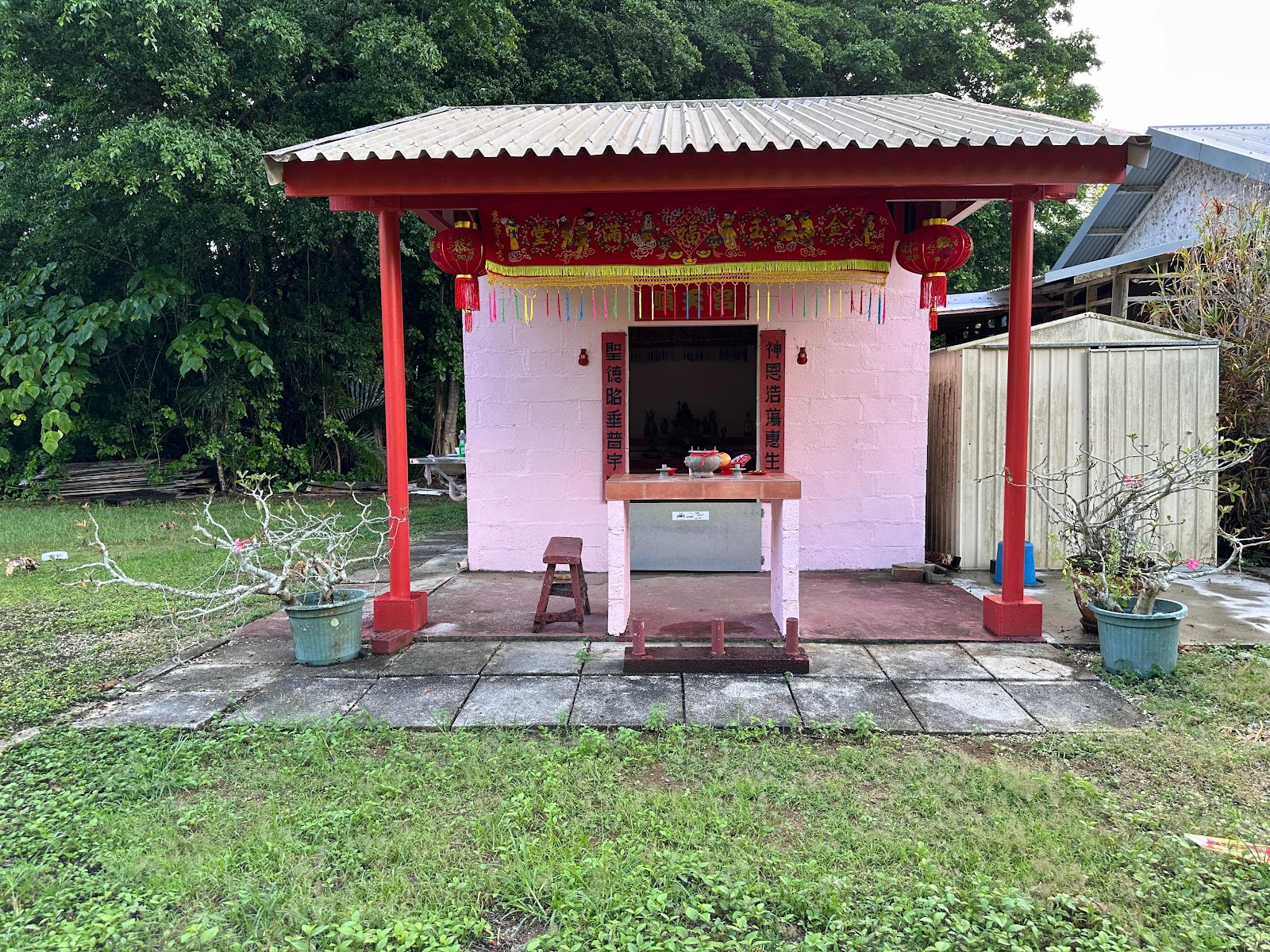
There are quite a few Chinese temples on the island,


Including one dedicated to the Muslim members of the Christmas Island community.


There is a Christian cemetery and a Muslim cemetery as well, but the vast majority of the population is Chinese who’ve been here five or more generations.

I went to Margaret Knoll - one of the main lookouts on the island. The sea was calm, and I could see the Abbotts boobies far down sitting in the trees.


Then I tried to go to the highest part of the island - Jacks Hill - but the road was shut after you reached the water tanks, and no wonder, since it overlooks the detention centre (which is currently mothballed). Before I came, many people asked me what was at Christmas Island apart from the detention centre. I said that there were lots of things, and I think you’ll agree.

I saw lots of birds that are native to the island. I only got decent pictures of the red footed booby


And the native bat.


I also thought this photo might give you an idea of the size of the robber crabs.


Tuesday, 13 February 2024

Dolly Beach

When I saw the sign at the roundabout yesterday, I initially assumed it couldn’t possibly be my camera. However, there aren’t many people on the island at the moment who could have lost a camera, so even though I’d lost it at sea, it was worth checking out. Both today and yesterday were public holidays for Chinese New Year, so I wasn’t surprised when the police station was shut when I went there yesterday. However, this morning I went, and IT WAS MY CAMERA! So I got it back, even though I lost it at sea. This is a miracle.

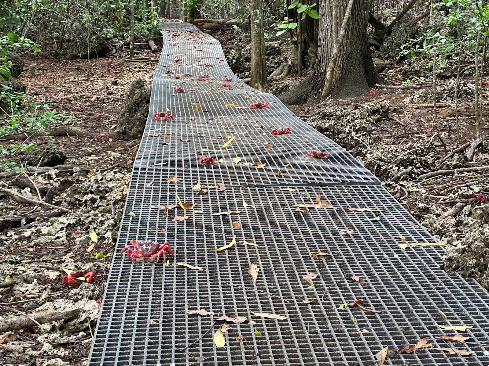
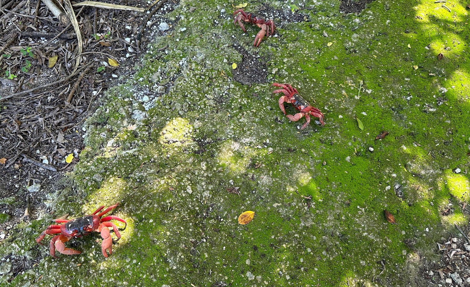
Today the road to Dolly Beach was open (half of the roads are still closed), so I was taken there. The road through the jungle was a serious 4wd road, with deep puddles and lots of variation in the level of the different sides of the road. We then took a boardwalk to the beach. One part had a fair number of red crabs.


Later, we saw blue crabs.


The jungle was very attractive.


When we reached the beach, I wasn’t surprised that it was voted the eighth best beach in Australia a few years ago. There’s coral, and a beautiful pool surrounded by basalt, so it’s often calmer than the rest of the beach (the beach was quite calm anyway).


But the chief attraction of the beach is the robber crabs that are the largest in the world.


It also has hermit crabs that are a lot smaller than the ones on Cocos (Keeling) Islands, and aren’t orange.


I spent the rest of the day resting, then went out to diner at the only food place open tonight (most shops have been closed for the four days, and finding food has been an interesting puzzle), and took your daily sunset photo.


The Grotto and the old settlement

Yesterday I was taken to a small cave system called The Grotto. The path in is fairly mossy, so my guide was very happy that there had been a few dry days.


We walked through the jungle to the limestone cave. There were several giant trees.


Including this one where I’m providing the perspective.


We got to the cave. You can see the sand at the bottom, but there’s also a couple of metres of clear water above the sand. And a red crab. It actually connects to the ocean, but from the ocean side, it’s very difficult to see where the cave is.


We then went along the path to see the coastline and the blowholes.


Including the dragon rock.


Later, I went snorkelling. I saw a very interesting sign at the roundabout, but when I went to the police station, it was closed.


I decided to visit Tai Jin House, originally the official residence of the governor of Christmas Island. It’s now a museum, but it’s shut because of Chinese New Year.


I took a photo from there across towards where I’m staying.


And the gun emplacement that was hastily added at the beginning of the Second World War.


I then continued around the road to where I took tonight’s sunset.


Sunday, 11 February 2024

Christmas Island

Christmas Island is a seamount - meaning that it’s an extinct volcano that rose steeply 5,000 metres from the ocean floor, about 60 million years ago. It gradually rose higher over 10 million years. Each time it got higher, coral formed, creating a  limestone cap, and the sea eroded it creating cliffs that you can see everywhere around the island.


There are thirteen small shallow beaches with coral, so the island was extremely difficult to land on, and to populate. It was settled much later than Cocos (Keeling) Islands, by the Clunies-Ross family, because a lot of phosphate had been found here. They planted a coconut plantation and a banana plantation. The British Phosphate company took over the island from the Clunies-Ross family and employed Chinese workers. Phosphate mining is still the major employer today. Most of the phosphate went to Japan in the early 1900s. During the Second World War, the Japanese took over the island, and deported a lot of the Chinese to Singapore (only 16 came back). The European workers had already been evacuated to Singapore, where they arrived shortly before it was taken. In the attack, the phosphate works were machine gunned by air, and the workers tried to disable the plant. The Japanese only succeeded in taking one shipment of phosphate back to Japan during the entire war.

Most of the island is national park, covered in tropical jungle with lots of endemic plants, birds and animals. The jungle and the limestone makes it extremely difficult to travel through, 


and telephone reception is only available near the settlement. Every visitor is asked to pick up a PLB from the police station, so they can be found if they get into trouble. Unfortunately, wolf snakes, giant centipedes and yellow crazy ants have recently been introduced into the island, and some of the endemic species are really having trouble surviving.

And here is tonight’s sunset with a sliver of moon.


Saturday, 10 February 2024

The Settlement at Christmas Island

Today I started out taking a photo from my current accomodation.
It’s a really nice place, a fair bit above the water, but on the lowest road in the settlement. I went along it, past the phosphate works, around the roundabout (that only has two entries - the entire reason for it seems to be that it allows people to do a u turn), and on towards some housing that’s been voted as having the nicest gardens,


And the wharf.


I was in search of somewhere to eat. Unfortunately, nothing was open. It’s Chinese New Year (with two public holidays on Monday and Tuesday), and the time of year when everyone takes holidays anyway, so there are very few shops that will be open for the first four days I’m here. Fortunately, by the end of the day I’d found the only grocery store that was open today (it was open between 4pm and 8pm) and I’d found everything I needed.

I had a tour of the town. The tour guide was exceptional. We picked mangoes and breadfruit at the park. He also pointed out the banana plantation that I can go to and pick my own bananas. While we were in the park, which is the next level up in the settlement, at Poon Saan (which means halfway up the hill), we went to the lookout there. Where I’m staying is at the end of the bottom road in the photo.


The end of the crab migration is imminent, but they still have most of the road closures. You can see the barriers they put along the sides of the road to channel the crabs toward particular crossings they’ve made - either underneath the road, or a crab bridge.


There are still a lot of crabs migrating.


I went for a snorkel at Flying Fish Cove (next to the wharf in the earlier picture) and saw tremendous numbers of different corals and fish. It’s been identified as one of the best snorkelling sites, and it’s really great. There were a lot of other people in the water, but there was plenty of room for everyone. Unfortunately I lost my underwater camera, and although I spent a lot of time looking for it, I couldn’t find it. I’d been having trouble with my mask, and while I was sorting that out, I lost my camera, but didn’t realise it until the next time I had mask problems.

Lastly, here is a picture of the sunset from my abode.


Friday, 9 February 2024

Change of island

Today I have spent the day going from Cocos (Keeling) Islands to Christmas Island. As it’s deemed to be an international flight, you are supposed to check in two hours prior to departure. The baggage counter opened at 10:20am. The airport itself is still closed - you line up along the side of the airport. Then comes a wait until noon when they open the doors to the departure area. During this time you can order a pizza in the cafe outside, which will be delivered to you in the departure lounge. They put all the pizzas through the X-ray machine before they open it to passengers.

It’s a one and a half hour flight, and there’s a half hour time difference. 

When we landed I was on the wrong side of the plane. When we left Cocos (Keeling) Islands today, this is what I saw.


And this is Christmas Island.
You can see how different they are.

I don’t know how I managed it, but there are two things Christmas Island is noted for - Chinese new year and the red crab migration. They close a lot of roads for the red crabs. All those roads are closed, and the Chinese new year festivities start tonight.

And I managed to see the opening ceremony.


And a red crab, as I got out of my car.


Thursday, 8 February 2024

Direction Island

The beach at Direction Island was named Australia’s best beach in 2018. I agree that it’s a superb beach, and better than any of the other beaches here. The island isn’t inhabited, although you can camp there. The ferry visits it on two days of the week, in the morning to drop people off, and at two or two thirty to bring them back. It has no water, but there are shelters dotted along the entire beach, barbecues, and several toilet blocks. The last shelter has two emergency surf boards, and there are emergency kits in some of the shelters. So it has everything. Even wifi.

It was raining this morning and it looked unpleasant, but this was the only day I could go.


When I arrived at the island, I took time to wander through the trail about the island. I was very taken by one of the signs, which showed the telegraph network just before the First World War. It isn’t complete, but illustrates the strategic position of the Cocos (Keeling) Islands. Direction island was where the communications hub was located. It was the site of Australia’s first naval battle. Germans landed and destroyed the hub in the First World War, while the Japanese destroyed it in the second. Cocos (Keeling) Islands were a major defence base in the Second World War with up to 2,800 defence personnel here (including at Direction Island). The ruins of the communications hub are on the other side of the island and are gradually being pounded into the ocean as that side of the island disappears.

Then I wandered to the last shelter on the island. Direction Island is famed for “the rip”. You enter the water at the end of the island, and the current takes you along past some really good coral and enormous schools of large fish. You end up a fair way into the lagoon, but it’s all coral, so you swim back on the other side and do it all again. The tide was perfect, and the experience was amazing. 
Up that end of the island you can also swim off the beach and see coral within a couple of metres of the beach. The other end doesn’t have any coral, and you can just swim on a nice beach.
On the way back we stopped at Home Island to take people who work there but live on West Island home for the night. You can see just how low the island is. It won’t take much extra water for Home Island to drown.
Then I went to find a sunset. As it was high tide, my first choice wasn’t available.