Saturday, 7 May 2016

Gophers

Today was gopher day - I saw some yesterday but today they were everywhere. On the edge of the hot springs pool, running across the road, climbing trees when I was walking.

I gradually went toward this mountain range as I drove to Haines Junction, and found out it is part of the Kluane National Park, which along with a couple of others cover the largest ice field outside arctic areas. Going to Haines from Haines Junction takes you along the edge of these parks which are a World Heritage area.

Kathleen Lake is just stunning.

Then I walked up a rock glacier.

And this slowly cleared the road - can't work out what it is, but it is the back.

The road just kept on getting more and more scenic, but it was getting late, so I kept on going - I can take more on the way back.

This is tonight's campground.


Friday, 6 May 2016

No Bears

Today ended much better than I thought it would. At the campground last night, I was told theFirst  People's museum was now open even though their brochure said it wouldn't open until June. It opens in June, but I saw what was there. It was a bit disappointing as everything was from at least mid 1900s, but it was interesting, and the person who begrudgingly let me in thawed out and gave me some excellent advice.

It was raining when I left. The travel agents highly recommended the road to Skagway (as did the museum lady) - this and the road between Lake Louise and Jasper are the only two roads that have been recommended. Unfortunately, the rain got worse, and the last place I saw at all well was at Marsh Lake.

Then the weather got worse, until I was driving through snow falling rapidly in whiteout conditions. Needless to say, the scenic beauty was hidden. US Customs pinched my red peppers, tramped mud through my van (which I swept this morning), and told me it was predicted to be worse tomorrow! Skagway is a tourist town with lots of twee shops, two totally useless petrol stations (one wouldn't take my moneand had no human to sort things out, and the other was too small for an RV), and two unpleasant looking campgrounds.

So I decided to go back - if tomorrow was going to be worse I mightn't make it through the snow.  But things started to look better.  The road out of town was more visible.

There was no snow, and the rain started to ease, and the cloud lightened. And the views became spectacular.

I particularly liked Eemerald Lake - taken from the same spot in two directions.

I reached Whiteehorse, and the information centre was still open, so I could find a campground (I had seen five that were still closed), as my GPS didn't know any campgrounds closer than Alaska.My campground tonight is in a Birch forest, at a hot spring.

Cold

It started snowing as I left the campground this morning. Not hard, but for several hours as I wandered along, so today's view wasn't what it could have been. However, the cedars (or whatever they are) looked marvellous with a sprinkling of snow. Especially as the lake was covered in snow. It looked like Santa Claus lived there.

Of course there were a few ice covered lakes.

There were some beautiful lakes on the way. This is Lake Boya, which is supposed to look different because it has shells on its floor.

Even better, there was a walking track to what was described to me as "the best beaver dam I have ever seen - and I'm a Canadian!"

And so onto the Alaskan Highway and Yukon. The scenery immediately changed to broad vistas.

There is a special part of Canada where the North American plate pushed up what is known as Quesnelllia, and this was part of it.

This is Where I'm staying tonight.

By the way, wifi is extremely problematic here. Last night wifi was only available from the resteraunt - the same happened tonight, but tonight you also got logged on for an hour at a time, so I can't stand outside the resteraunt when I finish this post - it will be sent tomorrow.

Wednesday, 4 May 2016

The coast?

The totem poles of Gitanyow are quite famous, as they are a large collection of them - there used to be about 50, but they were deteriorating, so they gave up some, and some were replaced by replicas, and others stayed, so now there are about 20 (I also saw at least ten in storage). And there is a totem pole museum, which explains the totem poles. Unfortunately the museum was shut.

Stewart and Hyder are on the Portland canal, and are therefore on the Pacific Ocean! This is a view of the Pacific Ocean from Hyder. Stewart is a Canadian town founded by two American brothers, while Hyder is a US town named after a Canadian.

The road to Stewart is very picturesque, and goes down a narrow gorge in places. The Bear glacier can be seen from the road.

Today's campsite is by the lake.

The Cassier highway has lots of black bears (I had to stop twice because a bear was on the road), and there was snow under the trees everywhere you looked. Life is getting colder.

Tuesday, 3 May 2016

Nisga'a

The Nisga'a live on the Nass river and where it flows to sea - the Portland Inlet - is the northernmost part of the Canadian west coast. About a thousand years ago, part of their land was overrun by lava in the most recent volcanic lava flow in Canada. Ravens stopped the lava from flowing as far as one of their villages. The result has been covered in lichen and has a number of plants growing in it.

Recently their artifacts have been repatriated from two museums, and the collection is housed in a new museum in their oldest village. The museum was built tall enough to house a totem pole that was taken from them shortly after it was carved in the 1800s, so it is in mint condition. The main reason I am going this way to Alaska was to see the lava beds and the museum. I was expecting the museum to be shut, but the curator had said that I could come anyway, and she gave me an absolutely marvellous tour of the museum. Inside the museum is a long house, with the front carved and painted to match one of their original long houses as depicted in a watercolour. The doorway is a specially made button blanket - which is traditional for the area, as they didn't have actual doors.

The masks are all from the 1800s, but the costumes have been made to fit.

There were several Sharman aprons on display. One had puffin beaks, which would have been traded from Vancouver or further south (puffins don't live this far north). But this one has goat hoofs, each carved to represent a canid, and from before the traders arrived.

There were a few black bears on my way - a mother and her cub, one that caused me to stop in the middle of the road because it was crossing, and two others, so I have now seen eleven! I think the cats I keep on seeing are Canadian Lynx - I've seen five so far.

And my site tonight? Again it has two views of mountains. Not bad, when you consider that it has been raining all day.


Monday, 2 May 2016

To the Coast

After going on a few walks around the site and town, I followed my museum guide's advice and visited the totem poles at Kispiox, which is evidently well known for its unsurpassed fishing. This town is also on the SkeenaRiver, which I followed all day, down to the sea.

Before I got back to the highway I went through the one lane bridges again.

The road to Terrance is just as beautiful as yesterday. I saw my sixth black bear which was twice the size of the others. When I looked back, the car behind me was stopping in the middle of the road.

Onward to Prince Rupert, the river became enormous.

I decided to backtrack to Terrance, so I might be able to do everything tomorrow, and the first place I tried was very closed, despite a sign saying it was open, but I was amazed to see humming birds there!


Sunday, 1 May 2016

'Ksan Campground

I suppose I had better tell you about the rest of the day before I get to the campground where I am staying tonight.

From Prince George, you are in farming country - mainly cattle and dairy I think, although there are unfenced fields which have been ploughed. The cedar and birch have been left as hedges in places, and it is rolling hills with lots of lakes.

Then, at Houston, you start to see snow and glacier covered mountains in the distance and you come across the largest fly fishing line in the world.

And then the mountains get nearer.

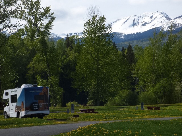
And then you take a road off the track to the 'Ksan campground and museum, which you know is shut, as are the other two first peoples museums in the area which are all supposed to be very good - none of them open for another week. And when you get there, you find this (note that there are two sets of mountains, one each side of the van) - and the best wifi you have had at any location on any trip...

As if that wasn't enough, the museum also has a number of long houses built in the traditional manner, like an original village.

This is all very special, but then the campground manager gives you a personal guided tour of the inside of the houses and the museum. They were superb - much the best thing on this trip so far. 

Life cannot get much better than this!