Saturday, 31 October 2015

And the Band Played On... - first day in Banos

Ecuadorians really know how to do festivals!

Today we woke up to loud explosions - firecrackers we are told, rather than the cannons we all thought were going off from time to time during the day - and the worst brass band I had ever heard. Later in the day there were two brass bands competing with one another, and the resulting sound was even worse.

It is currently after midnight, and there is dancing in the streets and loud speakers with speeches! I understand that the same thing will happen tomorrow.

Firstly, it is Flag day - the Ecuadorian national day. Then there are the celebrations for the day of the dead. I'm not sure whether there is another celebration happening as well, because there appear to be two types of parades happening. The first is a funeral procession - a band followed by people carrying roses and pictures of people, almost certainly associated with the day of the dead. Then there is another procession - a band followed by men carrying a mother and child depiction in a litter, followed by a number of people. As it travels, the litter is constantly strewn with rose petals. The litter is labeled for the name of the local cathedral - the virgin of the holy waters, which is holding two hourly services this weekend, so this procession may be bringing the faithful to mass, and it may be what woke us up.

I am told we will also be in the next town for its festival.

Today we decided to zip line, which was a lot of fun. Then we went to the swing at the end of the world. The swing was featured in National Geographic, and so has become a "must do" tourist thing.


To Banos

Somehow I didn't create this post.

Banos is the centre of adventure in Ecuador. It has horse riding, canyoning, trekking, zip lining, rock climbing, bridge falling (bungee jumping with a rope rather than a rubber band), and paragliding. All this because it is a river canyon with many, many waterfalls going into it. Most of the activities are in the 17kms along the river from town. The old road into town was one of the notorious roads of South America, but they widened it and built seven tunnels to get to the town (it is the major road along the spine of the Andes). The parts of the old road that were replaced by the tunnels are used for the activities and give access to some villages. These are very narrow and have a cliff on one side and enormous drops on the other, with the occasional broadening of the road so vehicles could pass one another.

Once we arrived in Banos half toe group went paragliding, while I explored the town. It has a large number of waterfalls, even though it isn't big. The hot springs are near the waterfall that is dedicated to the Virgin of the Holy Water, but there are also at least five other waterfalls within a couple of blocks. The town is pretty flat but it has cliffs and canyons on all sides of it.


Friday, 30 October 2015

Parrots - Second day of Jungle Lodge

This morning we woke up early to visit the place where parrots eat mud. Evidently this mud removes the toxins they digest when they eat Amazonian flora. We came back and had breakfast. Afterwards we visited the wildlife rescue centre next to the national park. Most of the animals there appear to be monkeys and parrots. Monkeys tend to be released into the wild, but most parrots and other animals don't because they have become used to humans, haven't learnt to fend for themselves or have been damaged so they can't fly well or look after themselves.

We then tried shooting darts through a blow gun. After that we visited a pottery village. All of this was done by canoe. Along the way we saw wild monkeys of various types, and birds, and people carrying on their everyday lives.


Thursday, 29 October 2015

White Water Rafting - from Homestay to Jungle Lodge

Before we left Delfin, he showed us gold panning, and we all got a mud facial treatment using their own mud straight out of a stream.

Then several of us went white water rafting. It was fantastic - three hours of Rapids and flat water interspersed. I remembered much of what I used to do when I was kayaking, so I did very well, and didn't fall out. Just at the end we had a torrential downpour which didn't last long. It was so much better than Disneyland! In the middle we had lunch.

After the rafting we went on to the jungle ecolodge by way of a village where they live with monkeys. The monkeys inhabit the main square, but know not to annoy the villagers by going into the shops.

The ecolodge is only accessible by canoe, but it is definitely several star, even if it doesn't have wifi. I thought you would like a picture.


Wednesday, 28 October 2015

Chocolate - second day of Homestay

As you already know, Ecuador is the home of the chocolate bean. Today we made chocolate - Roasting the beans, shelling them, grinding them, and adding the paste to milk and sugar (from local cows and sugar cane) and boiling it until it was a fondue into which we dipped sliced bananas. Everyone here has all four (the trees, the cows, the bananas, and the sugar cane). We did most of this in the hammock shelter.

Later, Delfin and his family showed us a few of the traditions of the area.

Waterfall - second day of Homestay

We wandered down the track to the national park and the waterfall. It was really nice to swim there after the hot walk. At least the track was fairly flat as most of the place isn't.

Tuesday, 27 October 2015

Home stay - First day

We crossed the Andes into the Amazon today. The scenery changes from vertical to more horizontal. In the vertical part, houses perch on the edge of the road above cliffs. The road we were on was closed for a few months earlier this year, as there was more rain than usual, and there were 47 landslides on the road. Fortunately it's open now, although they are still working on it, and in places it was still only one way. There are amazing waterfalls that appear to start at the very top of a mountain, and just fall in front of a cliff. Most of these were at landslides, which were all just a tumble of broken rocks and earth. When it became more horizontal it looked like Queensland - very lush but flatter (although the Andes were still in the background.

Twenty years ago Delfin started having guests stay with his family in the Amazonian rainforest. He has about 70 hectares next door to a National Park. The area is definitely not flat, but it is much flatter than where I have been. His family still tries to live a mainly traditional lifestyle, teaching others about their ways. He showed us around his forest, including a lot of medicinal and food plants. The photo is of one of the buildings as we came out of the rain forest after our walk.


Monday, 26 October 2015

Morning

We will be leaving the hot springs at lunch time, so this morning I walked up the river trail in one of the two national parks flanking the resort. Next comes a dip in my private hot springs and breakfast.

I think that the Internet problems are caused by all these new cameras. All of them have wifi capability, which means that everyone loads their pictures to their devices via the Internet. This is in addition to the phones using wifi. No wonder so many places just can't handle the traffic!

Sunday, 25 October 2015

Hot Springs

We caught a bus to a spa resort in the mountains. Only two of Ecuador's mountains are not volcanic, so hot springs are evidently everywhere. These are only a couple of hours south east of Quito, but already the water from the streams is running into the Amazon.

The resort is the best place we will be staying, and it is really something. My "room" consists of a bedroom with two arched windows and a relatively plain window, a shower/tub room which could bathe several at once, and a dining/kitchen/lounge room with two couches and a table and a meal preparation area that is in total smaller than the bedroom. Each suite has its own exterior hot pool, and there is a cold plunge pool shared between ten suites, all beautifully landscaped into grottos. The bath water is from the hot spring, and the floors are all heated by the hot spring.

It is also extremely high - about 3300 metres according to our notes - the highest we will be. The Internet is extremely patchy, and I hope to send this in a patch.

Saturday, 24 October 2015

Quito

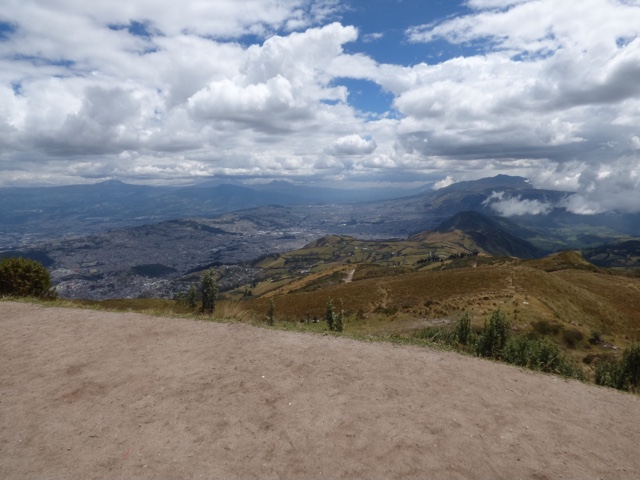
We all went up to the top of the hill above Quito (14000 feet as against 9000 for Quito itself). And then we went further up. The view was fantastic. The view of Quito includes the volcano that started to smoke recently - it is the double peaked mountain in the middle of the photo. The other view is the top of the mountain from the same place. 

At the bottom of the cable car, we separated, and so ends the first part of myEcuadorian  experience. In two hours I meet my new travelling companions.

Because we will be travelling, I'm not sure when the places we are staying will have Internet and when they won't. As I have already seen, even when a place has Internet it mightn't be reliable.


Birds

We have been having difficulty getting an Internet connection - everyone is trying at once, so we all fail. Besides, the resort has had some problems, and I'm sure constant rain doesn't help.

I went to a renouned bird watching sanctuary today, and the owner took us to see several rare birds, including a chick. For those interested, the chick is the second photo. It is not a blob of compost, but a 14 day old chick in a mud nest. The yellow bit is its mouth (which is closed), there is an eye and a couple of nostrils, and is belongs to the first bird (which is a male).

Tomorrow we go to Quinto, and I join the next tour in the evening.


Thursday, 22 October 2015

Resort Again

It's really nice to be in the one place for a week, with someone else organising where we are going, what we are doing, and having lectures and discussions at the resort. It is a time of relaxation between constant movement.

The resort is feeding us what I suppose is Ecuadorian food at most meals and each meal (including breakfast) is different. For breakfast today we had a banana dough mixed with scrambled eggs, as well as fruit and juice. We always have fruit juice, different at each meal. The banana dough is probably plantation, rather than banana, because it doesn't have flour added to it, and we have had it in several meals. I have asked for a list of our meals, so I can look up the recipes.

Today everyone has gone zip lining, but I am here having a peaceful day. Next week is likely to be more strenuous.

Yesterday, between sessions, I went down the track to the river and waterfall. It has rained every evening, and there has been some rain during the day as well. For instance, yesterday had rain at breakfast, drizzle at dinner, and some rain in between. But there was a part of the day without rain while I visited the river. However, the track was very steep and slippery - especially where others had slipped.

There are three distinct vegetation zones on the way down. Firstly you go through giant bamboo clumps. This bamboo would be 20 metres tall and the stems are quite thick. They were using it for all the structural poles and rafters for the greenhouses and shade houses at the reforestation project. It isn't native, and is quite invasive.

The next level are trees with white trunks a reasonable distance apart, like a eucalypt area. Finally there was dense forest, with a native tree fern, and lantana growing up the trees.

The photos are of the waterfall at the river, the building where I am staying from beyond the pool and hot tub, and the valley from the same place.


Tuesday, 20 October 2015

Chocolate Factory

We all know that this is where chocolate came from, so a visit to a chocolate factory is wonderful. I can tell you that their brownies are fantastic! The photo is a chocolate tree.

We also visited a rainforest reforestation nursery and helped.

Monday, 19 October 2015

On the way to the retreat

We visited an open air museum that incorporated the equator. There were various activities - balancing an egg on a nail, a tub which was emptied on the equator, then a couple of metres on each side of the equator. The tub was amazing - no whirlpool on the equator and one in each direction on the sides.

We then went for lunch at the crater (one of only two in the world where farming occurs in the crater).


Cloud Rainforest Retreat

We are a fair bit lower than Quito, but are still in the Inca highlands. The incas built at least one temple complex directly on the equator, and the retreat is exactly on the equator (well all the buildings are in the Southern Hemisphere but there is a line in a paved area to indicate where the equator passes through the property. The building in the foreground is where I am staying, the one at the back is the dining room and conference room. The yellow area is the pool complex. There is a path down to the river and a waterfall through the rainforest. The photo is taken from the equator.

It has rained each night.


Saturday, 17 October 2015

I'm Here!

I arrived in Quito a few hours ago, and it's very late here. Had a good trip, with an Ecuadorian artist and a member of a medical corps sharing the group of seats. The artist had been teaching and exhibiting at three universities in Kentucky. He showed us some of his work. 

Breakfast is at 8am and we leave for the cloud forest at 9am.

Really loving it!

Friday, 16 October 2015

Contemplation

I'm sitting here in my hotel room, about to do my washing and go to bed early so I can get up and catch the early plane to Ecuador (I won't arrive until very late tomorrow, so I probably won't post).

So what did I do in the US?

Visited the following parks:

Arches National Park
Bryce Canyon National Park
Canyon de Chelly National Monument
Canyonlands National Park
Capitol Reef National Park
Chaco Culture National Park 
Dead Horse Point National Park
Death Valley National Park
Dixie National Forest 
Goblin Valley State Park
Grand Canyon National Park
Grand Staircase Escalante National Monument
Kodachrome Basin State Park
Mesa Verde National Park
Monument Valley Navajo Tribal Park
Painted Desert
Petrified Forest National Park
Pink Sand Dunes State Park
Red Canyon State Park
Sunset Crater National Monument
Vermillion Cliffs National Monument
Walnut Canyon National Monument
Wupatki National Monument
Zion National Park

Probably a couple more...

Really had a wonderful time on a part of the trip that wasn't meant to happen.

Saw some examples to show the median Australian is richer than any other country.

Learnt to hate driving on the wrong side of the road, driving an automatic car, driving with an incompetent navigator, and especially learnt to hate driving in Los Angeles! It rained this morning, and there was a mudslide blocking a major highway. This is not a picture of that driving experience - when the heavy rain started a truck decided to turn across my side of the road and completely block it - but of a normal Los Angeles traffic jam on both sides of the freeway in the middle of the day today. I was stopped, so I took it out the front windscreen.

And for the next week, I may not be able to update the blog because I have been told that you need to catch a taxi down to the village to get internet, and I don't know how often I will be able to do that.


Thursday, 15 October 2015

GPSs Have Limitations

Today started in Arizona, visited parks in Utah, went through Nevada, and finished in California.

There was a state park I wanted to see called Coral Pink Sands. As it is a state park, I needed to pay, but I arrived there before the rangers were manning the gates, so I didn't. There are enormous sand dunes, made from sand blown from the Navajo reservation! Unfortunately the GPS didn't know about this park, so I wasn't going to see it until I saw a sign on the road.

Then I went to Las Vegas via Zion National park. I said earlier that the road through the rest of Zion was fantastic, and now I have some pictures. Unfortunately the GPS kept on trying to go an alternate way. However, I tricked it. Maybe it knew there were roadworks.

After that, I visited Death Valley. It was magnificent. The colours (on a cloudy, rainy day) were pretty good, and the colours of the rocks are so variable! There were many signs of the recent flash floods. Unfortunately, the GPS decided to take me out of the park down non-major roads, and I didn't realise this until too late because the sign had said the town I thought was next. Unfortunately the sign had lied. However, although I went through a bit of unpaved road (it was being remade for two miles), and a big puddle, at least the sections I was going through were not closed!

The first picture is Zion and the second is Death Valley.


Wednesday, 14 October 2015

Colorado River Again

I saw the Grand Canyon today. I thought that I had to see it since I told everyone that I would be going to that area. However I didn't see it from the main Grand Canyon viewing area. I entered from the east, so I went to the desert viewing area first. The parking was enormous, and I seriously wondered whether I would ever find my car again. And the people! I also went to the Navajo viewing point, which was small and uncrowded. So then I decided to go to the other end of the canyon. There is a bridge across the Colarado river one mile before it officially ends.

After that I saw Marble Canyon and the Vermilion cliffs, but because it was late I don't think any of the photos are any good.

In the morning (before the Grand Canyon) I went to Walnut Canyon and Wupatki and Sunset Crater. These are pueblo Indian archeological sites - Walnut canyon has cliff face buildings and Wupatki has the ruins of villages. Both have an enormous number of dwellings, and you can go into the places that remain.

So what will I give you in the way of photos? A number. One of each in the following order: Walnut Canyon, Wupatki Pueblo (there were a number of other Pueblos on the site), and a Grand Canyon shot from each end, and finally an enormous rock.


Tuesday, 13 October 2015

Queues are a Way of Life

The road to Many Farms (that is the name of a reasonably sized town) was pretty, with a canyon wall on one side, and the occasional spikey rocks to remind you that it is not too far to Monument Valley.

Canyon de Chelly includes another group of Anazasi ledge dwellings - these were a bit above the valley, rather than being a bit below the Mesa. There are quite a few of them, and they are bigger than the ones at Mesa Verde. One ledge is called Massacre ledge, as over 100 Navajo were killed there by a group of spaniards.

I saw pectoglyphs there and at the Painted Desert/Petrified Forest National Parks, which I went to later. The Painted Desert is in an enormous number of colours. The early settlers must have had a huge dilemma in all the canyon lands. Taking their wagon trains through the valleys would give them a water source, but it would be much easier to travel along the mesas.

On my way through the park, they were fixing the cracks in the bitumen, so there was a long section which was only one lane. Then when I got to Holbrook, we waited on a bridge for a train, that is possibly the second longest I have ever seen, go through. It finally did, and we started again. However, I only made it as far as the boom gate before the one coming the other way came through. It was shorter, and I counted 47 carriages!


Monday, 12 October 2015

One Too Many Screws

Today I decided to go to Monument Valley, and hopefully another park.

I didn't say but yesterday I was in New Mexico, which is a very poor area of the US - including mobile home parks... 

Monument Valley is in the Navajo Reservation - possibly on the other side to where I was. New Mexico has enormously wide roads that are slightly under-maintained. As soon as I got to the reservation, the road narrowed to one lane in each direction. Going into Arizona was obvious, as the road suddenly became better. Monument Valley is almost exactly on the border of Arizona and Utah. After that border the road was being made (I missed the turn off, as I thought the signs were part of the border and roadworks), and one side of the road was missing for the next 11 miles! There was a half a mile queue waiting their turn at each end of the roadworks.

As well as this, my car found a screw on the road, so I needed to have a tyre fixed.

All in all, I was several hours later getting to Monument Valley than I expected.

But Monument Valley is well worth it. It has been used in many westerns. I didn't see any cacti there. There were cacti in California and Bryce Canyon, but I don't think I have seen any since. The wait for the one lane that was open had some benefits, as the scenery on that part of the road is similar to the scenery in the park.

Sunday, 11 October 2015

Meet Some Indians

Mesa Verde is a world heritage site, and no wonder! The local Indians started to farm here and gradually built more intricate buildings, on the Mesa, and later built homes in cave shelters some distance down the cliffs. The cliffs were alive with the sound of building, as they are quite close to one another (for instance, from one viewing point you can see three separate sets of cave shelters with building), and are up to five stories under the ledge of the cliff.

I was lucky to be able to join a tour of the balcony house. This involved going up and down several ladders up to ten metres and crawling through a tunnel on your hands and knees. It was all worth it.

The site includes dwellings from each period, and it was really good to see how their architecture changed over time.

I'm really glad I took Charlotte to LA, because if I hadn't, I probably would never have seen Mesa Verde. Besides which, it was fun to see her pleasure.

Saturday, 10 October 2015

Colorado (State not River)

I'm now in the state of Colorado.

The place I stayed in last night had a door next to my room, and people kept opening it all night. It thumped every time, so I didn't get much sleep. The room was nice, and I had tried three places before I found one that had a vacancy - this was before I went to Canyonlands and Dead Horse, because after the queue at the Arches I suspected that it would be difficult to find somewhere to stay. 

Anyway, I am stopping early because I'm tired and early tomorrow I will go to Mesa Verde, which is very close.

This morning I saw the other part of Canyonlands Park - the view of the Needles. Actually I saw them yesterday from the other side. Look at the first picture (which is from yesterday) and see the things in the distance that are lit up. They are the Needles. Today I saw them from slightly less far away, but facing east rather than west. I went out to 1200 zoom and the haze is bad, and I am seeing them from not much closer.


Friday, 9 October 2015

Colorado (River not State)

There are three parks very close together - The Arches, Canyonlands and Dead Horse. Today I visited all three. 

The Arches started out with marks against it. The queue to enter was half a mile long (the distance from the turnoff to the entry according to my GPS). And when I was half way to the entry, someone went down, and let a lot of people behind me through (bypassing the entry). As I have an annual pass, I would have been one of them if I had been further back. The park has several rock arches -  hence its name. There is also a possible previously existing arch which would have been much larger than any existing arch. I wasn't terribly impressed by the arches. One is on the Utah number plate, and is much smaller than I expected. However, there are a lot of very tall almost two dimensional rocks, and big rocks sitting on much smaller rocks.

Dead Horse looks out over the Colorado river which is 2000 feet just about straight down. Canyonlands looks out over more of the Colorado valley, as well as the Green river valley. If I read the information right, at one place you were 5000 feet above the river. There were some very serious cliffs around, and the whole land had been etched out by the rivers. It was amazing. As it was very misty, the photos aren't good but if you look hard you can see the Colorado about where the front cliff is white. The river twists vigorously and the gorges at the side are also the Colorado. The park originally had uranium mining and gas exploration. This is a desert area with 10 inches of rain a year.

Thursday, 8 October 2015

It is Autumn

Today was absolutely fantastic. Highway 12 which I had been following was really good between Escalante and Boulder. This is not surprising, as the cream from Escalante was still being delivered to Boulder by mule train in the 1940s, and the area was the last part of the US that was mapped because the canyons formed by the Escalante river were so complex. In fact I think I read somewhere today that Bryce Canyon is part of the Escalante river canyon formations.

I had breakfast in a cafe with a view of the river from way above it. Then I went down Burr Trail road, which goes through Grand Staircase Escalante National Monument (not sure why some parks are monuments) to Capitol Reef National Park (where it becomes a dirt road) where I turned back. The Grand Canyon will have to be very special to be better than the incredible wall that the Escalante river has carved that you see as you come back along Burr Trail.

I continued on highway 12 which went to 9600 feet, and was overlooking the two parks, turned onto highway 24 which almost immediately started to go through Capital Reef, and then went to Goblin Valley Park.

While I was still on highway 12, I kept seeing yellow stuff at the tops of the hills, as they became cliffs, and I couldn't work out what it was, as the pines were all below the yellow stuff. It turned out to be birches in full autumn colours. This was really nice, as the canyon lands were below. I think the formation may be the grand staircase, but possibly not.

During the day I saw several sets of petroglyphs, but as they were all on sandstone, the were not very old - they were all AD rather than BC.

Goblin valley is well named, and nearby are a number of squarish rock formations that just seem to come out of the ground, and this one is called Grand Temple. Most of the goblins are all together in a huge amphitheatre, but three are separate.


Wednesday, 7 October 2015

Sandstone is not Tuff

It is possible to see too much of a magnificent thing. Today was Bryce Canyon, a park noted for its fairy chimneys (they call them hoodoos). There are thousands if not millions of these, as well as other formations from weathered sandstone.

Turkey has something similar in Canakkale, but theirs are flat on the ground, and are from a volcanic rock called Tuff. There aren't rock falls, and many houses are built in the fairy chimneys, or extend into the hill side. Entire towns are part building part cave. Greek Turks even built underground cities housing tens of thousands of people in the Tuff.

In Bryce Canyon the fairy chimneys are on very uneven ground, and as they are from sandstone they are much more prone to sheering away. However, there are multitudes more of them, and the mass displays are amazing. The uneven ground also gives variety to the display.

There were too many people at the park (I was even in a queue to park my car at one lookout). I thought Zion was crowded yesterday but that was nothing compared with Bryce! Although it was fine today, excess water is still a problem. Some tracks at Bryce were very muddy, and there is water at the sides of the roads.

I drove out along highway 12 which is very scenic, and went to Kodachrome Basin park before staying for the night in Escalante. Tomorrow I will see more around here (if water doesn't stop me) and go to Goblin Valley.


Tuesday, 6 October 2015

Canyons are Gorges (and they are gorgeous too)

Last night I was still in California. Today I have crossed several states and a time zone, so it is now one hour later, and I didn't even realise it. Actually I kept on trying to work out why it was going to take so long to reach Zion National Park.

I crossed into Nevada to go to Las Vegas (they are definitely into gambling - as soon as you cross the border you see a casino), then I was suddenly in Arizona (all these signs said I was), then Utah (no casinos).

Of course it is all desert and I have come to appreciate Joshua trees, which tend to be the only thing sticking up more than a metre, apart from mountains. Most of the way was very flat (there is a Great Basin national park in the area) with mountains in the far distance, and a marker every so often saying something like 4000 feet (presumably the elevation).

Then instead of mountain range, you start having cliffs, and singular mountains that resemble chimney tops rather than roofs, and the flat bits become smaller and smaller. And sometimes your road becomes a bridge over a gorge. And then you are in Utah, which also appears to be wetter (there are trees and it is greener, although it is still pretty dry country).

I went to Zion national park and walked some of the tracks (several were closed because of flash flooding) although it was raining a bit. Most of the peaks have biblical names, and the river is the Virgin river. You are in the canyon rather than looking down on it. However, the road out is much more spectacular than the gorge (or canyon), even though it is a series of switchbacks and tunnels.

I'm not sure where I'll go next, Bryce Canyon or the Grand Canyon. I've read somewhere that the Grand Canyon is better from this side, and it's not that far away.

Monday, 5 October 2015

Rain Goes Somewhere

Maturango Museum was on my list of places to see in Los Angeles, but it was a distance away, so it didn't happen. However, I thought I could go via it and Death Valley to Las Vegas, when I was looking at the options this morning.

There are a large number of pectoglyphs in the area, and some cave paintings at Ayres Rock. So I went. Unfortunately it rained yesterday and today. The road to Ayres Rock was awash, so I was advised I couldn't get there, and highway 190 through Death Valley had flash flooding. I did see the museum. So I went back to the southern route to Las Vegas. The mountains are lots of different colours, so the route was quite pretty (although not as pretty as the Death Valley route).

On the way I stopped at Peggy Sue's 1950s genuine Diner. The owners had bought it in the 1980s and restored it to original - which was easier as it was genuine, but a bit derelict. They have the right menu and everything.

I am staying in Baker tonight, as I was very tired - probably from the ghastly LA traffic. Hopefully I will get away early in the morning.


No More Charlotte

Tonight I left Charlotte at the airport. Tomorrow is the start of a new episode in this trip.

So what happened today? It rained overnight, so it would have been silly to travel to Palm Springs and back, so we stayed in the area. The Gamble House is a renouned Arts and Crafts movement house - they say the best example in America. If you arrive there at 11:30am (when the bookshop opens), you can normally get a ticket to one of the one hour tours of the inside that run between noon and three pm. Somehow the bookshop was open earlier, and the first tour was at 11:45 - and we were on it.

It is a shingle house of three stories plus basement. They appear to have only used wood in the construction - no nails. The woodwork is really good, and there is a lot of designer glass. Motifs are repeated throughout the house. For example, the front doors and over-Windows have a tree with flowers decoration. This is repeated in the wood carvings along the top of the walls in the lounge room, and in inlays of semiprecious stones in the bed heads in the main bedroom. All the wood carvings use the grain of the wood to enhance the carving.

There is a self guided walk of the neighbourhood, which we completed next, including a Frank Lloyd Wright house, and many houses built by the architects of the Gamble house (the Gambles owned Proctor and Gamble). This was well worth doing.

After (or rather during) the walk, Charlotte was hungry, so we went to the Umami burger place in Pasadena for special hamburgers, and to the cold slab ice cream place for mixed ice cream (like the concrete places in Canberra, only they mix the ice cream on a cold marble slab, by hand.

By this time, it was time to go home, do my washing, and go to the airport. As usual, there was a traffic jam on part of the freeway, but I got there on time.

The Frank Lloyd Wright house looked rather unlived in.

Saturday, 3 October 2015

Perth Beaches are Better

The Chumash Painted Cave is on the way to San Francisco along the coast, and is one of the few Native American things I found on the internet. The cave only has a small amount of painting in it, but any is better than none.

The road up to the cave from the coast is very steep and has spectacular views.

We then went to Zuma beach (the best beach in California) in Malibu. The sand was course and very hot, and the beach was very wide, so our feet were sore by the time we reached the ocean. The expert verdict was that Perth beaches are better.

We saw three Frank Lloyd Wright buildings - one had spectacular views on the way, as it was in the hills behind Zuma beach, the second was in the middle of an area of narrow streets, and the third was a block of shops in the Beverley hills shopping street (next door was channel).


Friday, 2 October 2015

Five Mirrors

Today we went to the Broad Museum. We didn't have a ticket, and as it has only been open for a week, pre booking is essential. We got there at 11:20am (another late start, combined with the diabolical traffic in LA) and the guide said there would be a two hour wait. So we did a self guided tour of the Disney concert hall, had breakfast, and went back to the Broad. WE GOT IN! It took about 20 minutes.

UCLA was next (the traffic meant we arrived at 2:45pm), and due to a conversation I had with someone at the Broad, we managed to have a much better time there this time. It has the old buildings of Melbourne Uni, with the spaciousness of Monash or La Trobe. We found the union building, and had pizza.

Then back to the shops to finish spending all Charlotte's money and have tea.

Today's picture is of the fountain at the Disney concert hall, to continue yesterday's theme.

Oh, and the mirrors? It was the grand opening of the first shop in the world for this makeup company (until now sold online and in other places). We scored five mirrors.


Thursday, 1 October 2015

Greek Garden Composition Gone Wrong

You are familiar with Greek garden design - concrete the yard and add some concrete furniture and some mosaic from broken plates... Watts Towers were built by an Italian over 34 years. He dedicated his life to it. His wife left him. Whenever he wasn't working he was adding to the construction. It is amazing!

Charlotte didn't get up until very late, so it was noon by the time we emerged. We got to Watts Towers at about one, and as it is locked except for tours (the next one was at two), we went for lunch at the Watts coffee shop. The lunch was very good - but enormous. We ordered one chicken salad between two, and didn't finish it.

We then went to the local mall, and Charlotte shopped until she ran out of money, then we had burgers at Johnny Rockets. I told Charlotte that they were in Australia, but she didn't believe me until I showed her where it was in Perth! It's good to be able to access the internet while you are in a fast food outlet.